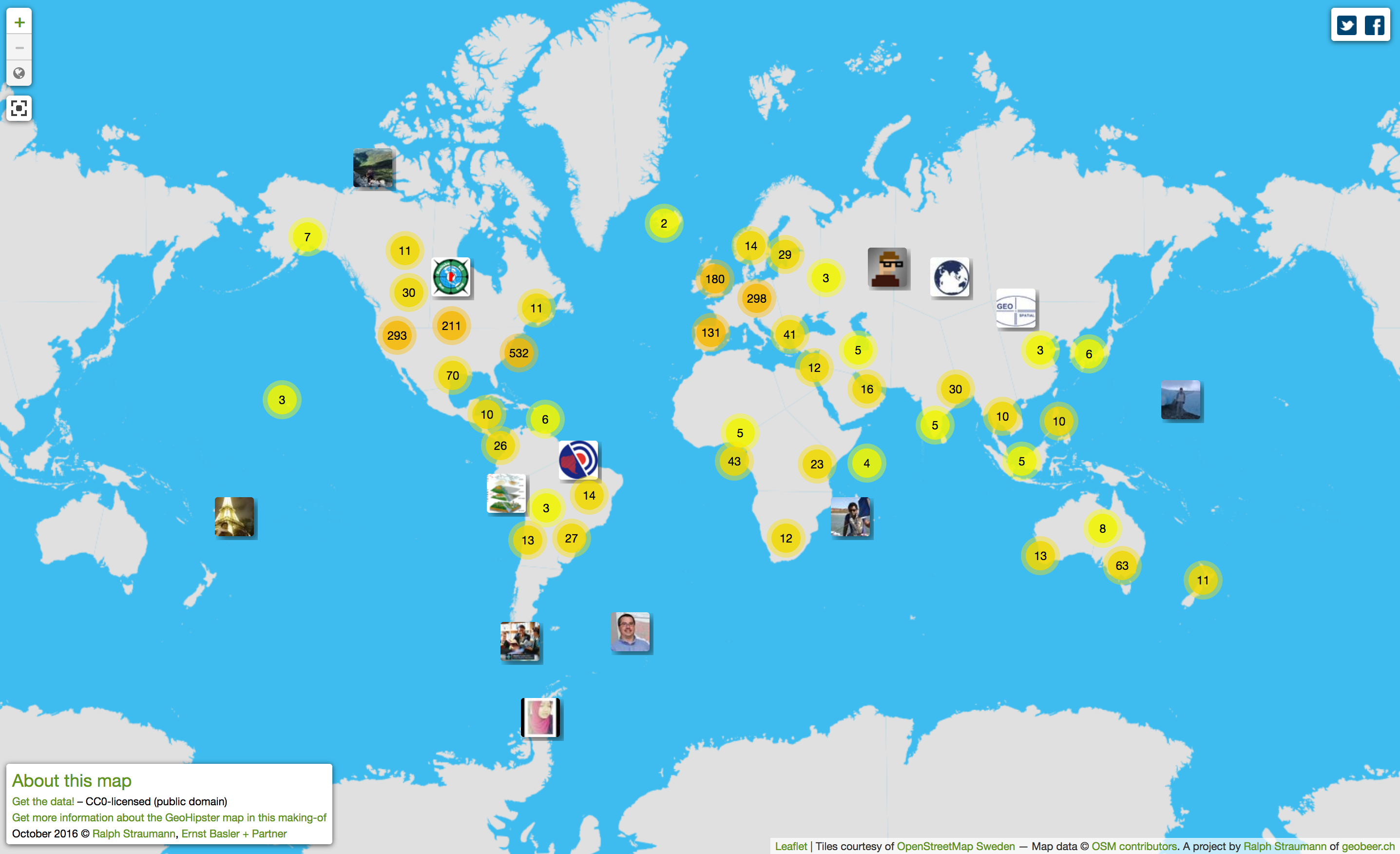
I’ve updated the GeoHipster Map, i.e. the map of the followers of @GeoHipster that I initially published in 2014. Of course, this map is not to be confused with the authoritative Map of GeoHipster Sightings over at the headquarter. Mine is like the theoretical spatial distribution in equilibrium state, the Sighting Map is conceptually closer … Continue reading Updated global GeoHipster map
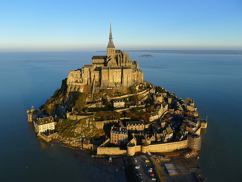
Digital Photography School has a nice gallery of kite aerial photography (or KAP, as it’s called amongst insiders): I have to date built various kites myself and actually also one of the KAP rigs shown in the gallery and have done some KAP experiments myself. KAP is lightweight, can produce affordable aerial photography and is … Continue reading Kite aerial photography gallery
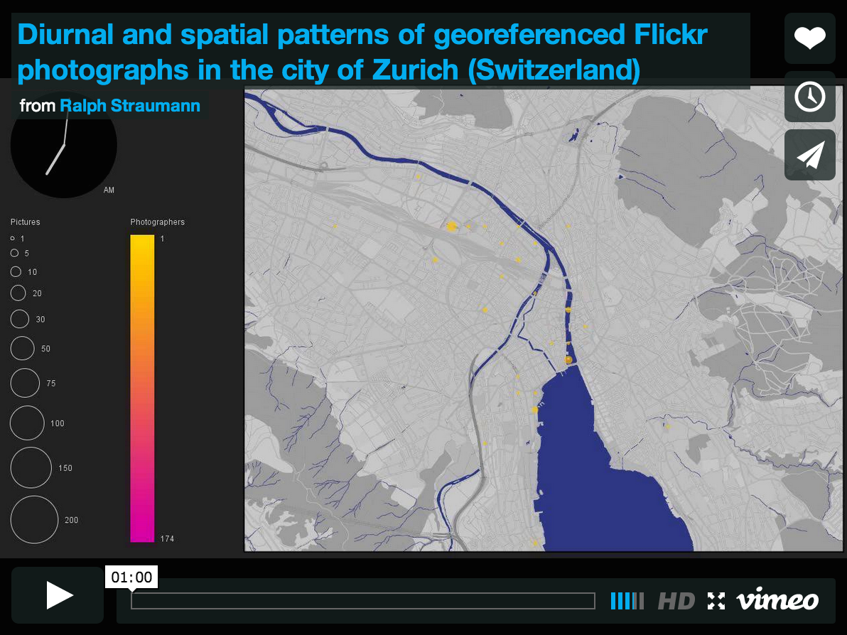
After my project proposal had been accepted, I have attended a workshop at ETH Zurich, titled “Cartography & Narratives” organised by Barbara Piatte, Sébastien Caquard and Anne-Kathrin Reuschel in last summer. The goal of the workshop was to explore “mapping as a conceptual framework to improve our understating of narratives”. Narratives are “an expression in discourse of … Continue reading Flickr as a vehicle of narrative: photos contextualised in space and time
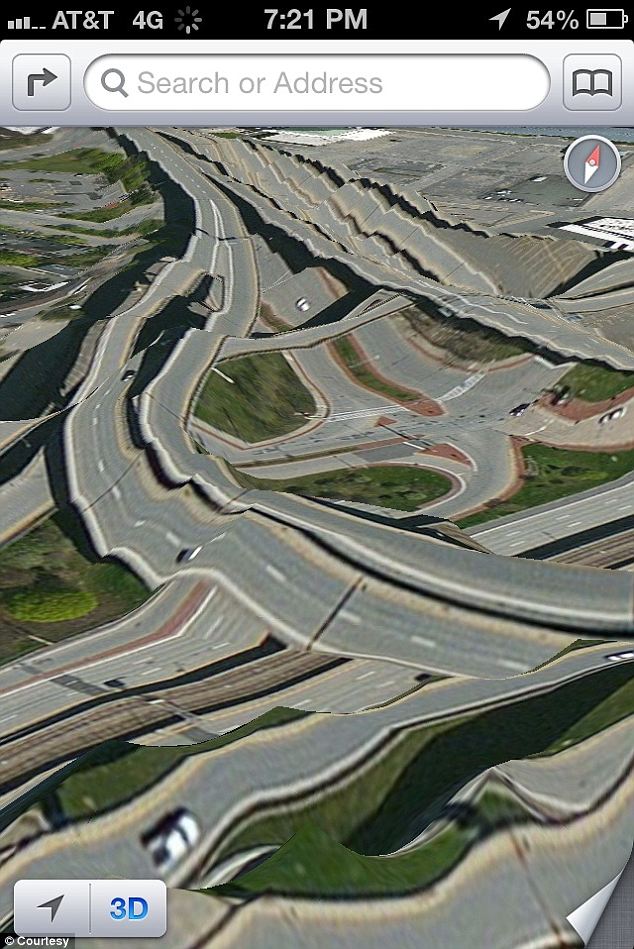
The internet has been abuzz about Apple’s iPhone 5 “mapocalypse“. The Verge has new background information: Apple took the decision to ship their own mapping app “over a year before the company’s agreement to use Google Maps expired“. Apparently, the people at Apple “felt that the older Google Maps-powered Maps in iOS were falling behind Android … Continue reading Background of Mapocalypse
I’ve highlighted the NY Times’ Opinionator blog before. Back then, Franc Jacobs wrote a piece about the delimitation of the rather fuzzy geographic entity called “Europe”.
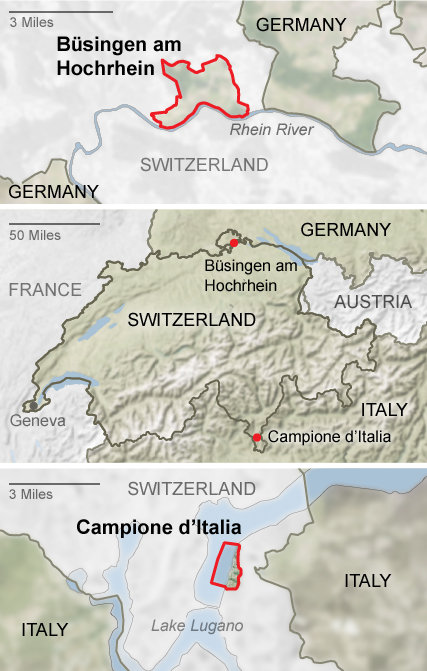
Today, there’s a new blog post about Enclave Hunting in Switzerland. After the mandatory clichées (the relevance of the “National Yodeling Festival” can probably be gleaned from the fact that it takes place only “once every three years”… – as opposed to, say, the Montreux Jazz Festival), the piece gets more interesting when it explores the many national (intercantonal) and in fact two international enclaves of Switzerland. The curious topology of the two Appenzells and Sankt Gallen are dealt with as well as the enclaves of e.g. Fribourg and Geneva.
The two international enclaves of Switzerland: Büsingen and Campione (Source: NY Times)
I acknowledge, it’s been rather quiet in these regions of the web. Why, you ask? I have been rather busy with a sort-of spinoff project I pursue with two friends. After having published about the Twitter network of journalists here, here and here, I directed my interest towards politicians. With two friends, Tom Wider and … Continue reading Where was I?
Mark Graham has posted a critique of a “Twitter map” that featured in the Economist at Zerogeography. The map was compiled by Portland Communications and Tweetminster and shows the number of tweets per country (original version of the map can be found in this presentation by Portland Communications): Mark Graham raises these interesting points regarding … Continue reading Economist’s Africa Twitter map provides some teachable insights
Via the GIS Doctor (in itself a fun blog) I got introduced to NY Times’ Opinionator. The Borderlines category on the Opinionator is maintained by author/blogger Franc Jacobs who “writes about cartography, but only the interesting bits.” Borderlines writes about interesting stories around country borders. So far, I’ve read the superbly entertaining and well informed … Continue reading Where’s Europe?
Still in last year, Cédric Moullet, amongst others MapFish and GeoExt contributor, sparked a discussion by his post “Why OpenStreetMap fails to replace official or proprietary base maps in a sustainable way ?” (note how this doesn’t sound like a question but bears a question mark ;) For simplicity, I will re-list Cédric’s 13 points here: … Continue reading OpenStreetMap: A valid competitor to official base maps?
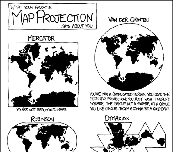
Today’s xkcd features a sociology of map projections. Hilarious! :) Mercator? You’re not really into maps. Take that, Google, Bing, Yahoo, Mapquest, …! PS if you’re not an xkcd regular: Don’t miss the mouseover caption. Continue reading What your map projection says about you
Maps chart territory and can thus be used and abused, for example, to convey one’s own interpretation of a territorial dispute. In such cases maps exhibit their considerable potential to invoke political disputes. With the advent of online mapping and the gripe very few large companies have on it (think Google, Microsoft, Yahoo and very few … Continue reading When mapping is political