The Future of GIS according to Esri
I’ve been a bit busy recently with, for example, attending the Esri Partner Conference and Developer Summit. If you are interested in the latest news from the GIS world, you can read a review by a colleague and me over on the Ernst Basler + Partners’ geo-blog.
Attending the conference (my first Esri conference) was nice. I met some interesting people that I’ve so far only ‘known’ from online (around here or over on Twitter). As Kenneth from Esri put it, it’s “always cool to meet twitterverse for real.”

Wikipedia research at OII
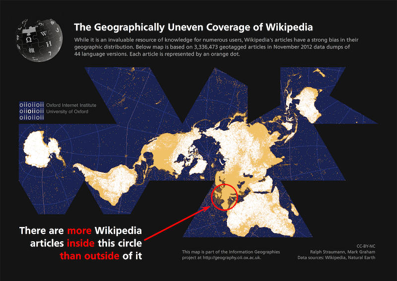
In other news, my colleagues at the Oxford Internet Institute (OII) and I have published a map that shows the dramatic lopsidedness of the distribution of Wikipedia articles over the globe (of course, in the meantime several more visualizations have been published by my colleagues, check them out here).
It is evident, that some regions almost don’t feature in the world’s foremost digital repository of knowledge at all and will thus not show up when users query Wikipedia or Google (who up to this point often list Wikipedia results prominently on their site). These places are further precluded from being present in any re-working or re-presentation of said repository in the forms of e.g. data mash-ups or augmented reality applications. In this way, digital non-representation likely yields rather tangible, real-world consequences.
GeoBeer
On a more fun note, Stephan and I together with local organisers from Inser had the sixth instalment of the GeoBeer event series here in Switzerland. On March 20, GeoBeer took place in Lausanne which means we visited the French-speaking parts of Switzerland for the first time, how great is that!
A short ‘Twitter review’ of the event is posted on our website. Xavier Mérour, one of the four speakers, published his slides on the complimentary nature of crowdsourcing and open government data today (in French). We cannot stress enough how much fun it was in Lausanne and personally I think it’s important we expose ourselves to our fellow Swiss citizens that speak another language (and expose myself I did – in a strictly decent manner! – trying to remember some French from school). (That’s also the only way to live up to our GeoBeer manifesto). Though, we are not there yet according to Arzu Çöltekin who tweeted:
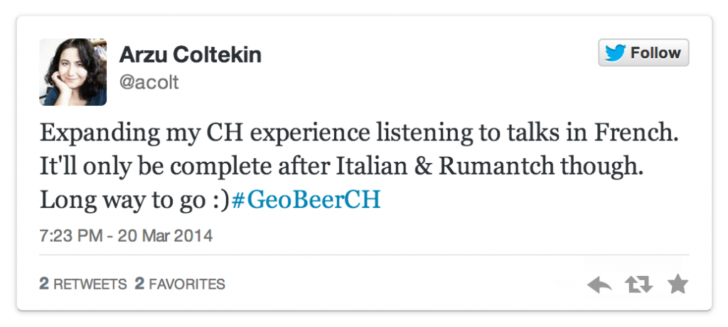
GeoBeer #7 will take place in Olten, by the way. Italian- and Rumansh-speaking areas will hopefully be due soon, too.
Finally, we also learnt that GeoBeer inspired the design of Esri’s GeoDev Meetup logo. How’s that for international cooperation.
Perishing averted, for now*
In the publications department, the last few weeks have seen three articles (and no, this pace is a complete, utter artefact!):
- With the team at OII we have published a paper titled “Uneven geographies of user-generated information: Patterns of increasing informational poverty” in the Annals of the Association of American Geographers. The paper is very much related to above Wikipedia visualization. Additionally to measuring the uneven geographies of Wikipedia content, we try to come up with a set of factors that explain to some degree the abundance and absence of content in different world regions. Mark gives some more detail on the paper on his blog Zero Geography. You can download the full text of the paper free of charge from the Social Science Research Network (SSRN).
- Together with Arzu Çöltekin and Gennady Andrienko I have published a full-article version of my earlier workshop abstract on analysing Flickr using visual analytics methods. The paper is titled “Towards (re)constructing narratives from georeferenced photographs through visual analytics” and is due to be printed as part of a special issue of The Cartographic Journal on “Cartography and Narratives” that has been edited by Sébastien Caquard and Bill Cartwright.
- Together with a colleague at Ernst Basler + Partners I have published an abstract in this year’s Swiss GeoSummit track on planning titled “Participation through federal geo-services and story maps“. The abstract is very short and I still don’t like the term ‘story maps’ (it seems to stick though), but I like the premise of our abstract that is basically about fostering political participation by everybody through offering people means to inform themselves in an easy and accessible manner about (at times complex) spatial planning or infrastructure projects – direct democracy at work! We will give a talk on this topic together with a representative of the Swiss national mapping agency Swisstopo in June at GeoSummit.
These have been the last two months.
Pretty much.
Well, I forgot to mention my blog post on R and open data (albeit in German), the second part of which is due to be published these days. And probably I forgot some more things; it has been a thrilling (but, frankly, also tiring) few weeks and months. Thanks to everybody involved!
But more is in the works, stay tuned, so long.
* as the adage goes: publish or perish :-/
One thought on “Catch-up”
Comments are closed.