(Blogpost auf Deutsch unter www.geo.ebp.ch)
I believe in abstraction for conveying information, or ‘rough’ context for information, efficiently. Since a while, hex and square tile maps are all the rage in the US. Check out this post by the npr visuals team on the technique, with some US examples:

An even greater example (imo) comes from After the Flood: the London Square Map. There’s also a fantastic write-up about it:
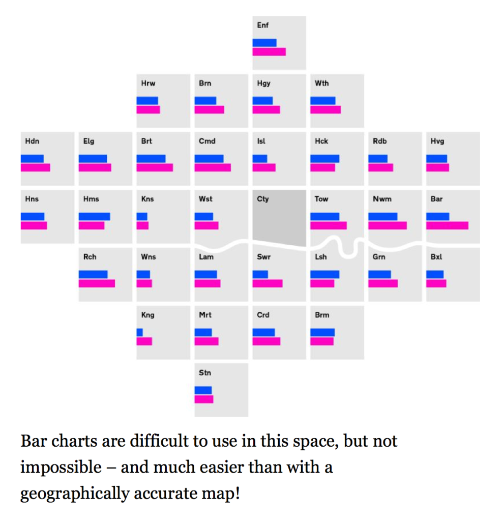
With these examples and some experiments by Adi Herzog and Yves Maurer in mind, I finished my attempt at a square tile map of Switzerland:

(Side-note: As you can see, Switzerland has this peculiar concept of half-cantons, that’s what the triangular shapes are)
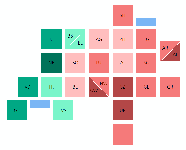
I put a shapefile, an svg file and an ArcGIS project file on GitHub. Feel free to use any of these resources, cc-by license applicable.
One thought on “Switzerland tile map”
Comments are closed.