Few days ago, Spencer Chen posted this picture on Twitter: and commented: Nothing is original, esp. in #design. (btw, these are NOT the logos of Medium, AirBNB, Flipboard, and Beats) That’s right. Spencer’s photograph contains the names of the institutions those logos belong(ed) to: a publishing company, a drive-in, an oil company and a city in Germany. … Continue reading Logo look-alikes
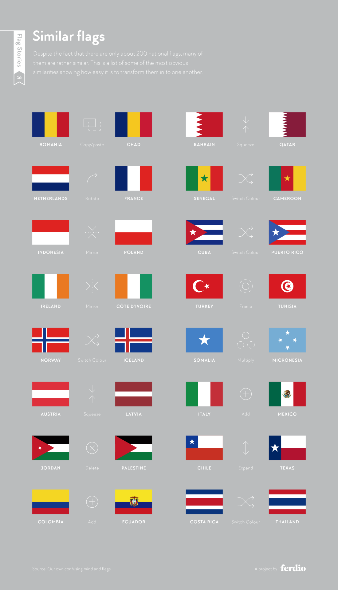
Alas, New Zealand’s proposition for a new flag design has been voted against a few weeks ago: But flags are always an interesting topic of discussion, from a design, cultural, historic, or simply aesthetic point of view. Via my friend Frank Ostermann I’ve learnt about Flag Stories, a website dedicated to the design elements (patterns, … Continue reading Flag geekery
A sunset on Mars: This picture been taken by NASA’s Curiosity Rover on the mission’s 956th Martian day (April 15, 2015). The colour has been “calibrated and white-balanced to remove camera artifacts” according to NASA. The colours are thus similar to what a human would perceive, although we might see a bit more blue. How amazing is this!? NASA sent … Continue reading Sunset on Mars
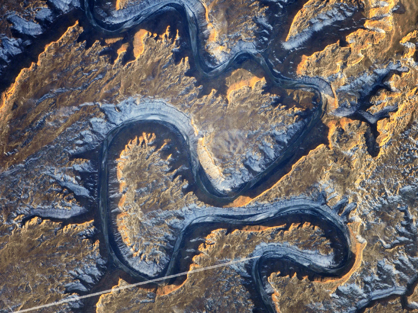
Wired has a slideshow of NASA’s best images of Earth that I’d recommend you to check out if you enjoy images from space! Below is a picture of the spectacular Bowknot Bend of the Green River in Utah (USA), as taken by an unnamed astronaut on board the ISS using a Nikon digital camera and 1000mm lens. … Continue reading Best images of Earth in 2014
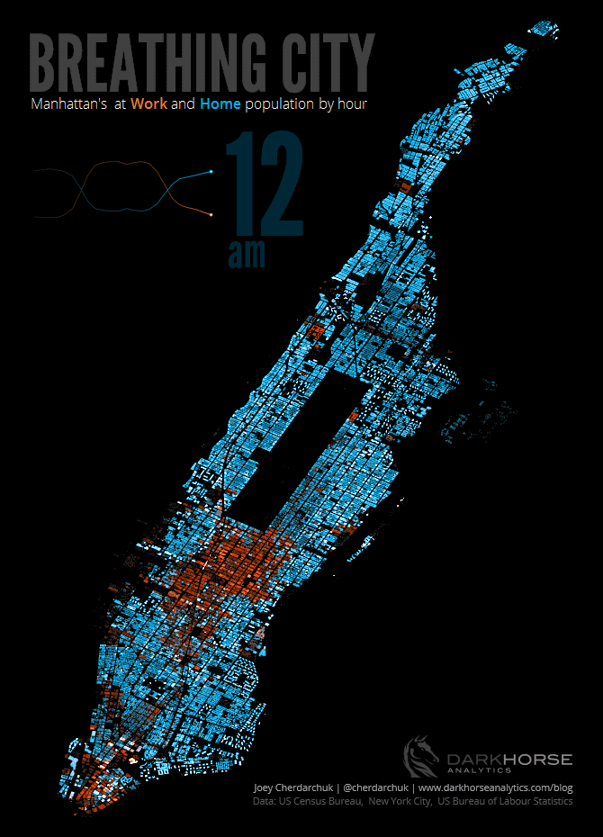
I will abstain from compiling my own list of “The best …”. Instead, I give you a small list of lists to be consumed at your pleasure: The Best Data Visualization Projects of 2014 by FlowingData All of Nathan’s picks “are interactive or animated or both”. “Telling for where we’re headed.” as he puts it. Among others, this selection contains … Continue reading The best in cartography and infoviz of 2014
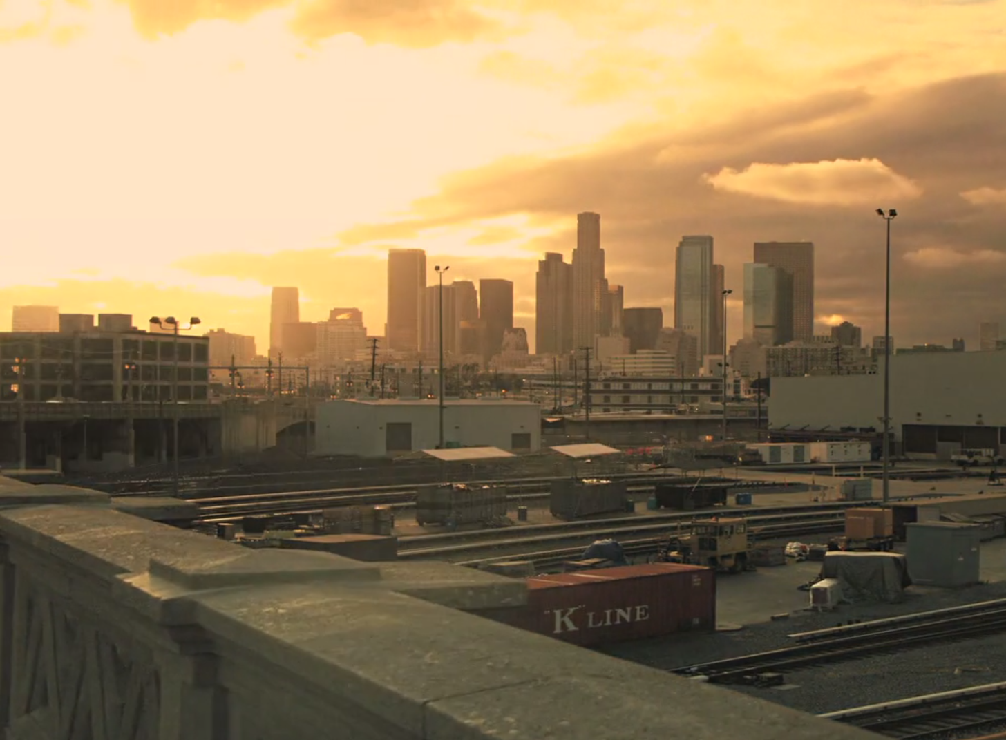
I was in L.A. the first time this March, before Esri’s Business Partner Conference and Dev Summit in Palm Springs. So this time-lapse film of L.A. by Sunchaser Pictures came as a nice diversion: (via BoingBoing) Continue reading Sunchaser Pictures: Angel City
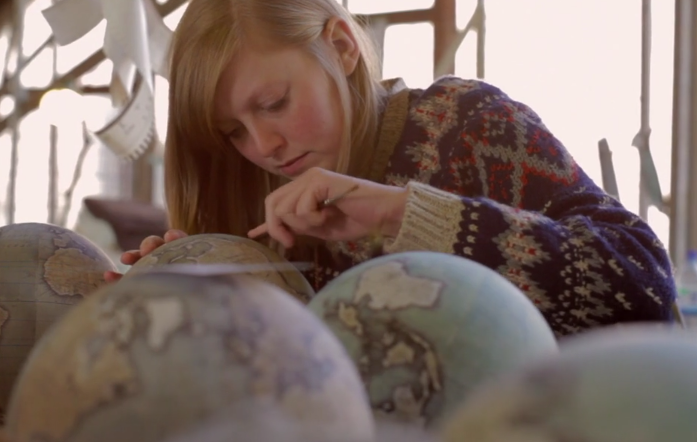
Geohipster or old-school cartography buff, all of you will enjoy The Globemaker, a Cabnine mini-documentary on Peter Bellerby, artisan globemaker and founder of Bellerby and Co. Globemakers. Takes 6 minutes of your time: View Peter and Co.’s products at www.bellerbyandco.com. Continue reading The Globemaker
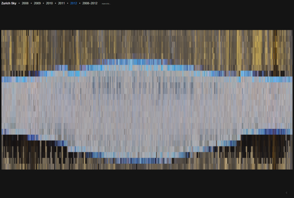
… is the title of my most recent project. It’s a bit artsy, but I think some of the concepts behind it may also have practical applications in this world of ever more abundant webcam footage (maybe need to think a bit more on this point later).
In Zurich Sky, I destilled yearly aggregates of the sky over Zurich Switzerland. I did this by first scraping tons of images from the website of the Swiss domain registrar SWITCH. They have two webcams, one in Zurich one in the Alps, whose images are publicly accessible in their archive (thanks!).
Zurich Sky: Web-scraped sky colour over Zurich, Switzerland
The SWITCH archive features one image every hour. Luckily for my project, the URLs of the individual pictures adhere to a nice structured format which makes automatic downloading of several thousand images rather easy. An example is here:
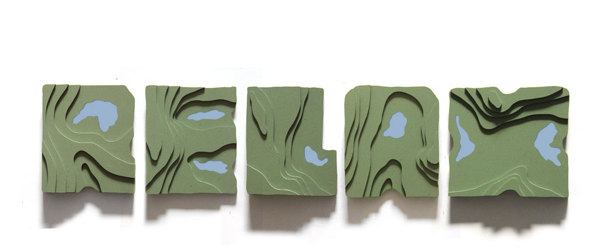
Neat idea by artist Siyu Cao: a typeface from topographic map excerpts. Hills, ridges and mountains signify letters’ bodies, lakes and low areas the empty spaces around and within letters. The typeface gains clarity when extruded to 3D: Made me wonder how a relief-shaded 2D version or a smoothly interpolated 3D version with imprinted contour … Continue reading Topography in typography
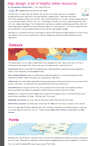
The Ordnance Survey blog posted a nice small compilation of cartographic resources today. They add some more colour resources over the ones I have already reviewed, as well as sites on fonts, symbols and “inspiration” (can’t all of us use some of the latter from time to time? ;-). Definitely not all of the listed … Continue reading OS map design resources
I propose Etymologic cartography as a field of study: Somebody had the simple but appealing idea to simply translate the toponyms on a map to English. In this case the subject in question is the USA: Some of the names are rather interesting (and were unknown to me), e.g. Asleep for Iowa, Flattened Water for … Continue reading Etymologic cartography


 (as can be seen from