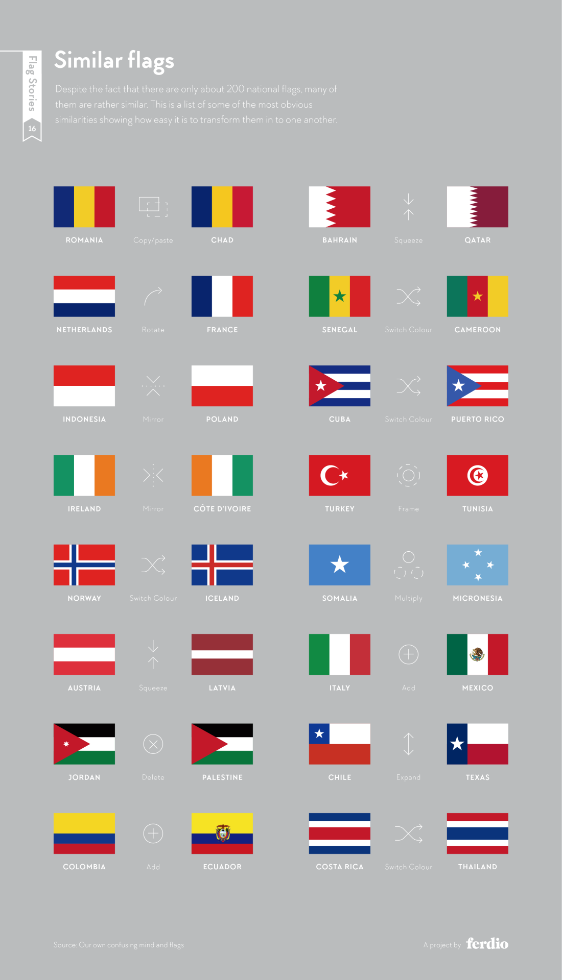
Alas, New Zealand’s proposition for a new flag design has been voted against a few weeks ago: But flags are always an interesting topic of discussion, from a design, cultural, historic, or simply aesthetic point of view. Via my friend Frank Ostermann I’ve learnt about Flag Stories, a website dedicated to the design elements (patterns, … Continue reading Flag geekery
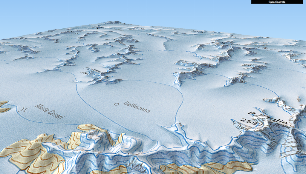
A few days ago, Swiss Geoportal (/the Swiss federal geodata infrastructure) tweeted a link to a visualisation of the largest ice extent over Switzerland – i.e. the last glacial maximum, LGM for short: They used a rather famous map of the LGM and draped it over an elevation service as a showcase for the newly-developed … Continue reading Visualising the last glacial maximum correctly
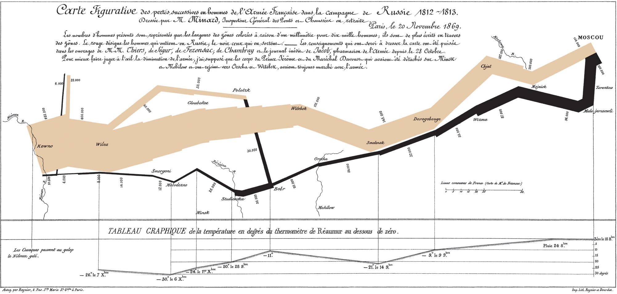
Some days ago, Martin Elmer (@maphugger) tweeted Numberphile’s video in which they highlight the famous Minard map. Martin and I exchanged a series of tweets on the topic: Martin had some substantial criticism of Minard’s graphic. Maybe, graphic is the crucial word here: A part of Martin’s and my discussion was about the (too?) subtle geographic … Continue reading Minard’s march – a hallmark visualization, rightly so?
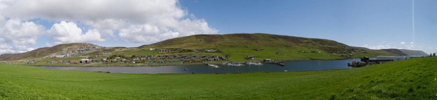
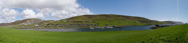
I can attest: Shetland (and presumably also Orkney) is a great place to visit. Not just for its landscapes, Shetland ponies and puffins, but also for its people, their language and – turns out – placenames!
On Shetland, you can travel from Rumblings to Quilse of Hageneap, from Povertynot to riches but at least to Longa Tonga, from Willa Minga Honga via Pund of Grutin and Cuppa Water to Drooping Point. Turns out, Mid Dublin is on Shetland as well as something called Fografiddle! If you are a cunning geographer, you should at least once travel to Cunning Geo!
I propose Etymologic cartography as a field of study: Somebody had the simple but appealing idea to simply translate the toponyms on a map to English. In this case the subject in question is the USA: Some of the names are rather interesting (and were unknown to me), e.g. Asleep for Iowa, Flattened Water for … Continue reading Etymologic cartography
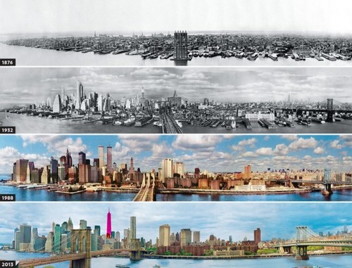
Interesting for history/urbanism/New York buffs: The evolution of the New York skyline and The evolution of the New York street grid (review of a book): The Commissioner’s Plan of 1811, the map and surveying scheme that set the blocks at 200 by 800 feet all the way up the length of the island, was an audacious … Continue reading Evolution of NYC
I’ve highlighted the NY Times’ Opinionator blog before. Back then, Franc Jacobs wrote a piece about the delimitation of the rather fuzzy geographic entity called “Europe”.
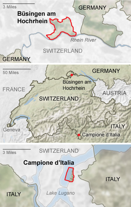
Today, there’s a new blog post about Enclave Hunting in Switzerland. After the mandatory clichées (the relevance of the “National Yodeling Festival” can probably be gleaned from the fact that it takes place only “once every three years”… – as opposed to, say, the Montreux Jazz Festival), the piece gets more interesting when it explores the many national (intercantonal) and in fact two international enclaves of Switzerland. The curious topology of the two Appenzells and Sankt Gallen are dealt with as well as the enclaves of e.g. Fribourg and Geneva.
The two international enclaves of Switzerland: Büsingen and Campione (Source: NY Times)
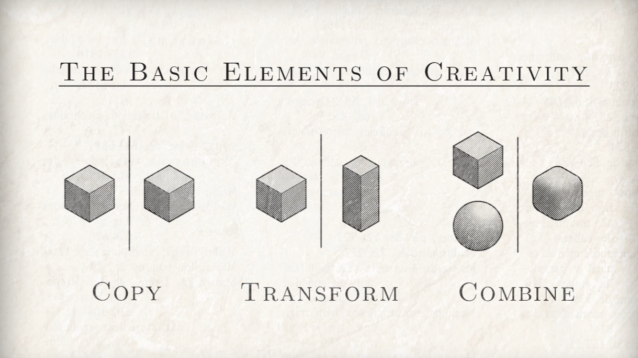
If you’re into creativity, you may have heard about Everything is a Remix. Its premise is that many things we consider original ideas are rather derivatives or combinations of existing ideas. It all comes down to COPY — TRANSFORM — COMBINE Everything is a Remix is a four-part video series which digs into the creative process. I’ve … Continue reading “Everything is a remix”, presumably also this title
Via the GIS Doctor (in itself a fun blog) I got introduced to NY Times’ Opinionator. The Borderlines category on the Opinionator is maintained by author/blogger Franc Jacobs who “writes about cartography, but only the interesting bits.” Borderlines writes about interesting stories around country borders. So far, I’ve read the superbly entertaining and well informed … Continue reading Where’s Europe?
Chicago Press gives away History of Cartography as PDF for free! If you are a cartography buff, you have to check out this offer. Topics span: Cartography in Prehistoric, Ancient, and Medieval Europe and the Mediterranean Cartography in the Traditional Islamic and South Asian Societies Cartography in the Traditional East and Southeast Asian Societies Cartography … Continue reading “History of Cartography” for free
I remember my early days of computing: There has been a lot of command line stuff going on (and QBASIC programming). Then came Windows 3.1 et al. on our home computer and Macs at school. Later, at university with Unix there has been more command line action again. Nevertheless, computing has clearly become more graphical … Continue reading The sketchbook holding the GUI design of early Macs
For once for a slightly different map: PopSci has a geo-centric map of the visible universe as it was acquired over time, from 1950 (top) to 2011 (bottom), precisely: Different object categories are coloured differently in the map. For example, the inner green ring above consists of minor planets, the blue dots are stars. In … Continue reading Map of the Universe
")