A sunset on Mars: This picture been taken by NASA’s Curiosity Rover on the mission’s 956th Martian day (April 15, 2015). The colour has been “calibrated and white-balanced to remove camera artifacts” according to NASA. The colours are thus similar to what a human would perceive, although we might see a bit more blue. How amazing is this!? NASA sent … Continue reading Sunset on Mars
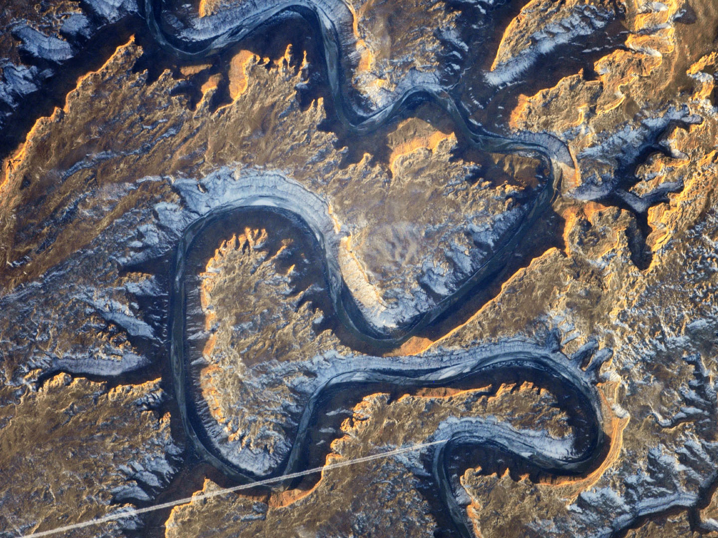
Wired has a slideshow of NASA’s best images of Earth that I’d recommend you to check out if you enjoy images from space! Below is a picture of the spectacular Bowknot Bend of the Green River in Utah (USA), as taken by an unnamed astronaut on board the ISS using a Nikon digital camera and 1000mm lens. … Continue reading Best images of Earth in 2014
… is the title of my most recent project. It’s a bit artsy, but I think some of the concepts behind it may also have practical applications in this world of ever more abundant webcam footage (maybe need to think a bit more on this point later).
In Zurich Sky, I destilled yearly aggregates of the sky over Zurich Switzerland. I did this by first scraping tons of images from the website of the Swiss domain registrar SWITCH. They have two webcams, one in Zurich one in the Alps, whose images are publicly accessible in their archive (thanks!).
Zurich Sky: Web-scraped sky colour over Zurich, Switzerland
The SWITCH archive features one image every hour. Luckily for my project, the URLs of the individual pictures adhere to a nice structured format which makes automatic downloading of several thousand images rather easy. An example is here:
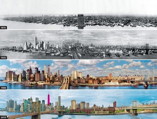
Interesting for history/urbanism/New York buffs: The evolution of the New York skyline and The evolution of the New York street grid (review of a book): The Commissioner’s Plan of 1811, the map and surveying scheme that set the blocks at 200 by 800 feet all the way up the length of the island, was an audacious … Continue reading Evolution of NYC
While the news on Historypin is still fresh, the next project made its way onto my radar. Like Historypin, the “What was there” project crowdsources photos from times past and has them geocoded by users/contributors a.k.a. produsers. You can browse the collection on their website or using their mobile app – provided you’re living in … Continue reading “What was there” project: More geocoded old photographs
While Google Earth is still around, it makes sense to maximise its usefulness. The Google Earth Blog shares some nice pointers how to tune your GEarth installation in case you experience performance issues. They’ve also recently covered a company called KMZmaps.com which offers a set of custom KMZ overlays for use in GEarth. Honestly, I … Continue reading Some GEarth tips
Behold this HD timelapse video of the view aboard the International Space Station (ISS). I can’t find first-hand information on its author, but PopSci claims that it was created by a certain James Drake, who stitched together 600 publicly available images shot from the ISS. The cities’ lights look great, especially together with the frequent thunderstorms lighting up the clouds (watch in HD and full-screen)! Continue reading “Timelapse video lets you ride the ISS – Canada to Chile in a minute”
Apparently, Iranian officials have decided to build a service to counter the success of Google Earth, which is described as a website that “was designed and built by the global arrogance for espionage purposes and to gather information from other countries” (Brigadier-General Mohammad Hasan Nami quoted in a Mehr news agency report). The new website … Continue reading A GEarth challenger from Iran
I don’t know how I managed to miss out on Historypin by an organisation called We Are What We Do. Historypin is a website that lets you overlay old photographs and other media on Google Street View imagery.
Living in Switzerland you don’t get to experience many weather phenomena as dramatic as hurricanes and tornados. However, a former colleague of mine investigates the movement patterns of hurricanes to find similarities between individual storms. And in 2004, I was professionally dealing with hurricane Ivan. Ivan was a Category 5 hurricane and is, apparently, the 10th most intense Atlantic hurricane ever recorded. Back then we ordered a Quickbird image (and were lucky enough to get one without too much cloud coverage) and did both a qualitative and quantitative damage assessment of Grand Cayman Island.
These have so far been my only exposures to the study of extreme weather events and, specifically, to the analysis of storm-induced damage captured by means of remote sensing. But some days ago NASA’s Earth Observatory has released a stunning image of a tornado track (of one of the several tornados which have struck Massachusetts in early June 2011) that is well visible from space. Head past the break for the image and more info.


 (as can be seen from