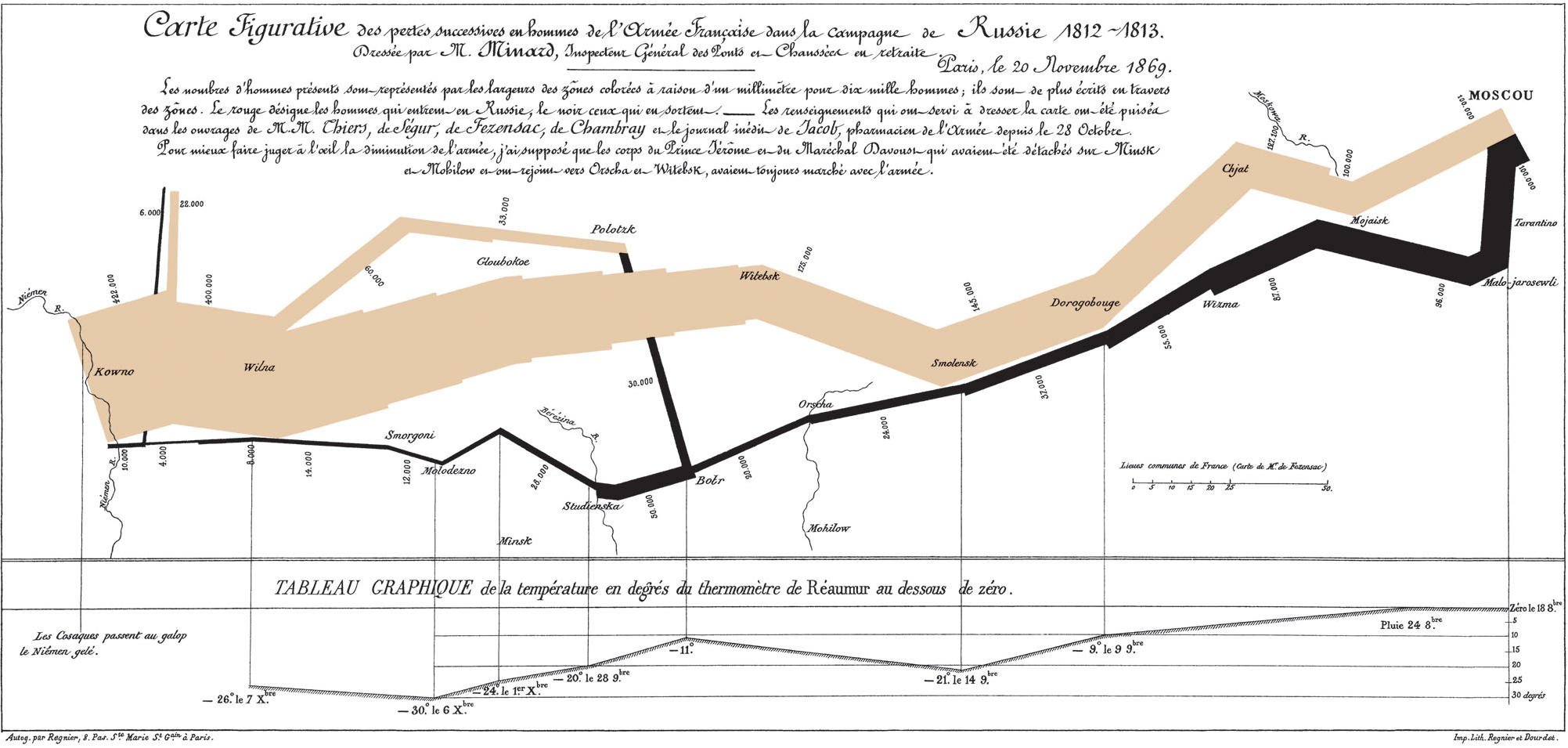
Minard’s march – a hallmark visualization, rightly so?
Some days ago, Martin Elmer (@maphugger) tweeted Numberphile’s video in which they highlight the famous Minard map. Martin and I exchanged a series of tweets on the topic: Martin had some substantial criticism of Minard’s graphic. Maybe, graphic is the crucial word here: A part of Martin’s and my discussion was about the (too?) subtle geographic … Continue reading Minard’s march – a hallmark visualization, rightly so?