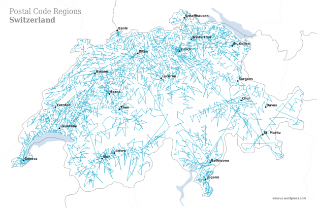
ZIPScribble Map: Switzerland – Part II
Having seen a visualization by Robert Kosara of EagerEyes a loooong time ago, I wanted to try to reproduce it for Switzerland using Processing. This is the second installment of a two-parts post covering this project, in which I will describe how to arrive at the final result, the ZIPScribble Map. I’ll do that in some detail, maybe this is helpful to somebody.
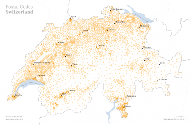
In the first installment of this series I explained my process up to an intermediate result: a map depicting all the postal code locations in Switzerland, like this:

This involved creating a basemap with TileMill, using Till Nagel’s MercatorMap class in Processing, finding and downloading postal code data from Geonames and writing a Processing sketch which makes use of all these. In this second installment I will explain how to arrive at a ZIPScribble Map for Switzerland from the above intermediate result. So from the first part we have many things in place already. What is missing are basically three things: Continue reading “ZIPScribble Map: Switzerland – Part II”