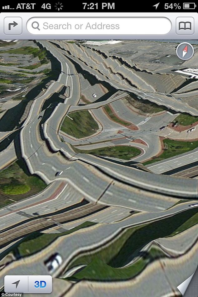
The internet has been abuzz about Apple’s iPhone 5 “mapocalypse“. The Verge has new background information: Apple took the decision to ship their own mapping app “over a year before the company’s agreement to use Google Maps expired“. Apparently, the people at Apple “felt that the older Google Maps-powered Maps in iOS were falling behind Android — particularly since they didn’t have access to turn-by-turn navigation (…).” Google on the other hand has been reported to have wished for more branding and inclusion of Latitude.
Anyway, “mapocalypse” is here and is presumably bound to stay a while, until either Apple fixes its globe or Google has finished their iOS6 mapping app and it’s been given admission to the app store by Apple. While competition is always a good thing, I’m not sure if Apple has indeed the capacity to amend their data on a global scale within a short time range. Combing through and improving the consistency of geodata from heterogeneous sources is a daunting task, after all. Google Maps (started 2005) and Google Earth (released under this moniker for the first time in 2005) also took years to arrive at a level which most users are happy with most of the time. The praise at the introduction of the new Apple maps is what their progress in quality will be measured against:
(…) when iOS software VP Scott Forstall introduced the new mapping system in June, he called it “beautiful” and “gorgeous” and stressed that “we’re doing all the cartography ourselves.”
(Source The Verge)