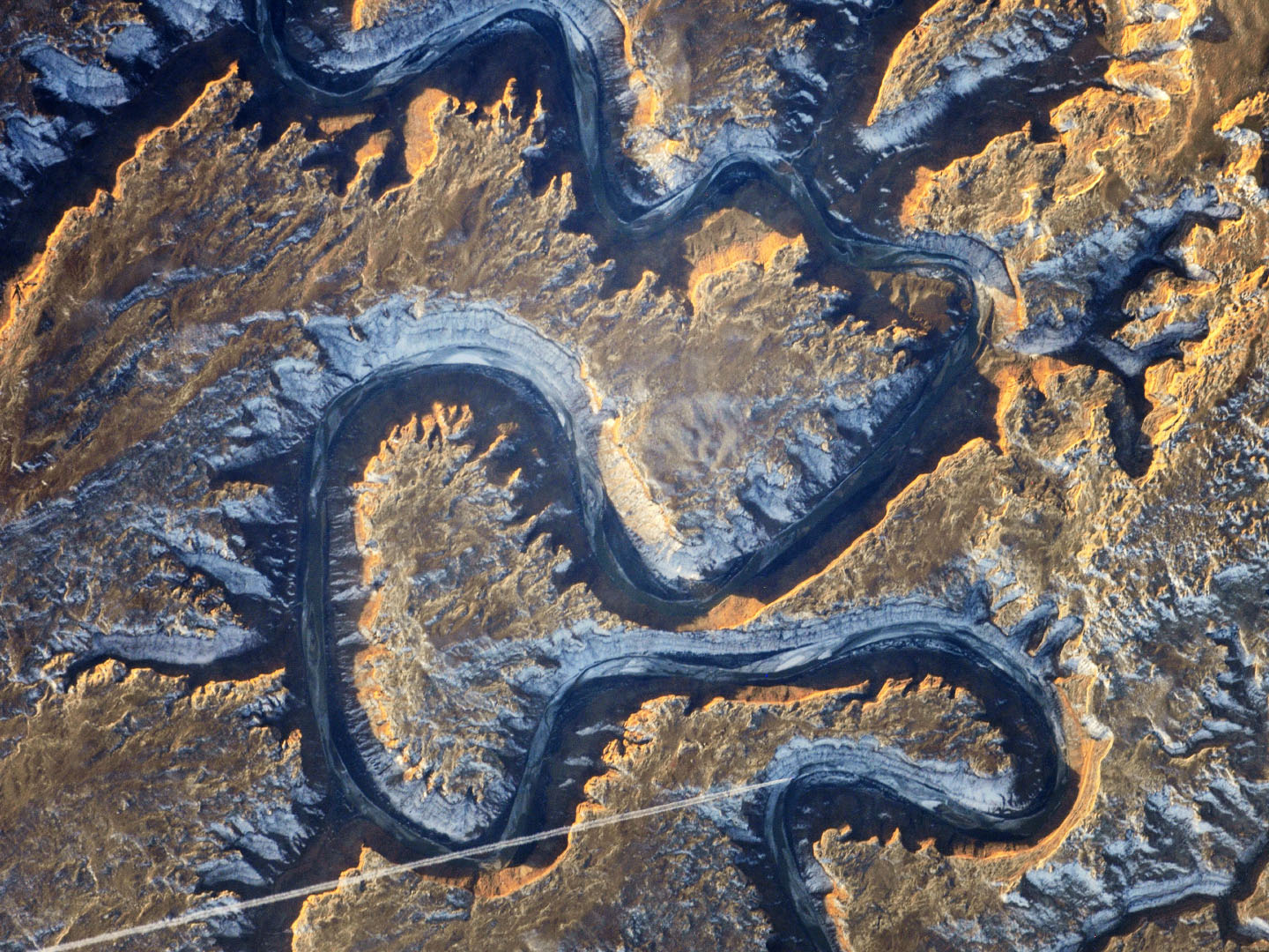
Trends in web mapping

A while ago, Alan McConchie and Beth Schechter of Stamen held a presentation titled Anatomy of a Web Map at Maptime SF, a weekly map hack-night hosted at Stamen Design. The slides can be viewed at maptime.github.io/anatomy-of-a-web-map (allow some seconds for loading). Click through for a thorough refresher and some innovative web map technologies. Even if you are familiar with the topic, you … Continue reading Trends in web mapping

First two publications of 2014

I’ve mentioned it before, but now the official links have arrived for my latest work in user-generated content research: Together with Arzu Çöltekin and Gennady Andrienko I have published a paper titled Towards (re)constructing narratives from georeferenced photographs through visual analytics in The Cartographic Journal. You can find this official version here. Similarly, the article Uneven geographies of user-generated … Continue reading First two publications of 2014

When NOT to use maps

Recently, I’ve stumbled across Noah Iliinsky’s Where 2012 talk When To *Not* Use Maps. The title immediately intrigued me. As a geographer and data consultant I’m convinced, an important part of my work lies in the question what tools best fit a purpose or a goal I want to achieve. But this is only one side of … Continue reading When NOT to use maps

Minard’s march – a hallmark visualization, rightly so?

Some days ago, Martin Elmer (@maphugger) tweeted Numberphile’s video in which they highlight the famous Minard map. Martin and I exchanged a series of tweets on the topic: Martin had some substantial criticism of Minard’s graphic. Maybe, graphic is the crucial word here: A part of Martin’s and my discussion was about the (too?) subtle geographic … Continue reading Minard’s march – a hallmark visualization, rightly so?

Catch-up

The Future of GIS according to Esri I’ve been a bit busy recently with, for example, attending the Esri Partner Conference and Developer Summit. If you are interested in the latest news from the GIS world, you can read a review by a colleague and me over on the Ernst Basler + Partners’ geo-blog. Attending the … Continue reading Catch-up

Happy 2014!

2013 has been a very interesting year for me: I rebuilt my website, started to self-host this blog and successfully applied for it to be included in the Planet Geospatial aggregator. I also revamped the Ernst Basler + Partner GIS blog. From March to May I had an unpaid leave from Ernst Basler + Partner (EBP) and worked in the … Continue reading Happy 2014!

Ubiquity of Python

I have written about the ubiquity of Python before and I’ve also given a talk in that direction at this year’s FOSSGIS conference (“Python as ‘glue’ in the GIS software domain: Sun glare analysis of road traffic accidents”). There is also a video of my talk here (but beware, it’s in German). So, this post by Tal … Continue reading Ubiquity of Python